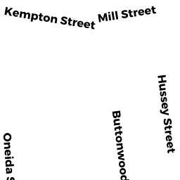
20 HUSSEY ST
Owner Information
TOUHEY ANN L
20 HUSSEY ST
NEW BEDFORD, MA 02740


Property Details
20 HUSSEY ST is classified as a Single Family Residential (Colonial).
The primary structure on this property was built in 1916. There are 1,960ft2 of built area within this property. There is 1,960ft2 of residential/living space within this property. This property is listed as having 8 rooms.
20 HUSSEY ST is valued at $253,800. The land is valued at $100,400 and the structures are valued at $153,400.
This property is in Zone RA. Confirm with local Zoning Board authorities to ensure there are no overlays or other easements on this property.
The most recent deed for 20 HUSSEY ST is recorded at the local registrar in Book 6794, Page 340. 20 HUSSEY ST was last sold on Thursday, February 19, 2004 for $100.
Assessment data from fiscal year 2021.
Flood Data
According to the FEMA National Flood Hazard Layer, this property does not appear to be in a flood zone. It may also be in an area not yet reviewed. Nonetheless, confirm this information prior to taking any action.
To view the flood hazards around this property, create a FEMA "Firmette" Map of the area around 20 HUSSEY ST.
Broadband Internet Providers
| Provider | Type | Bandwidth (mbps) | |
|---|---|---|---|
| HughesNet | Satellite | 25 | 3 |
| GCI Communication Corp. | Satellite | 0 | 0 |
| VSAT Systems, LLC. | Satellite | 2 | 1 |
| Viasat Inc | Satellite | 35 | 3 |
| Verizon New England Inc. | DSL | 10 | 1 |
| Comcast | Cable | 1000 | 35 |
Broadband service provider data from December 2020.
Adjacent Properties
- 773 ROCKDALE AVE
Two-Family Residential owned by GOMES CARLOS Z - 769 771 ROCKDALE AVE
Three-Family Residential owned by JORDAN CURT A - 763 765 ROCKDALE AVE
Two-Family Residential owned by SAUNDERS DONALD L III - 16 HUSSEY ST
Single Family Residential owned by COSTA REBECCA L - 24 HUSSEY ST
Single Family Residential owned by COSTA BRENNEN J